You can check the condition of Hamilton’s roads with this new interactive map
- Michael Kras
- 14 Oct 2020
If you want to stay up-to-date on the conditions of roadways all over Hamilton, you’re in luck: the city has just launched a new interactive online map that allows locals to view the current conditions of roads, city-wide and in real time.

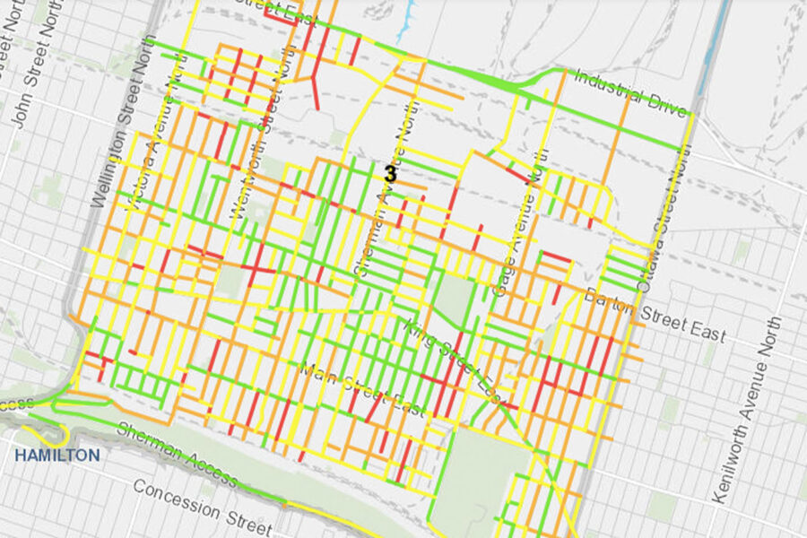
This new Road Condition Ratings map is the result of a pavement inspection carried out by the city in 2019, wherein numerous metrics, including Surface Condition Index (SCI) and Roughness Index (RI), were used to assess the overall condition of Hamilton’s roads.
How's the condition of the roads in your neighbourhood?@cityofhamilton recently completed comprehensive road condition indexing to help prioritize capital repairs and incorporate vision zero improvements – check your street on this interactive map: https://t.co/VMWGW65T2o
— John-Paul Danko (@JohnPaulDanko) October 2, 2020
The SCI is used when measuring and assessing visual defects in the road’s structure to give a general sense of what a road looks like. Then, the RI uses an electric sensor to measure and describe what a particular road may feel like to ride along.
These two metrics come together as the Overall Condition Index (OCI) which captures the look and feel of Hamilton’s roadways and displays them accordingly on the Road Condition Ratings map.
The map is separated out by ward, so ward residents can access up-to-date stats for the road conditions of their immediate areas and beyond.
To view map, click here.
Comments 0
There are no comments
Add comment