This map shows you if your street has been plowed in Hamilton
- Michael Kras
- 23 Nov 2020
If this past weekend’s brief flirtation with flurries is any indication, winter snowfall is inching closer and closer to Hamilton by the day; and a handy new interactive map has been created to help locals see, in real time, if the streets in their area have been plowed yet.

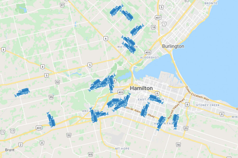
The city’s new ‘Plow Tracker’ uses Google Maps technology to give a comprehensive view of Hamilton and its surrounding area, showing where the local snow plows are currently hitting and what neighbourhoods have yet to be touched.
#HamOntSnow crews are finishing up work on major routes and are focusing on residential roads and bus stops. Be sure to give our operators space to do their work, and drive according to conditions.
Track our crews with #PlowTracker: https://t.co/xjWfhBNkTl— City of Hamilton (@cityofhamilton) November 23, 2020
The map will show users where the plows have been within the past 1, 2, 4, 8, 12, and 24 hours, mapping out their routes over those particular timeframes.
With Google Maps’ technology, users can also zoom, pan, change the view to satellite view, and also use street view. By clicking ‘Overview,’ the map will zoom back out to its overall view again.
This will undoubtedly be a valuable resource for Hamiltonians as the winter months approach and at least a handful of significant snowfalls can be reasonably expected. Bookmark the website now!
Check out the Plow Tracker interactive map on the city website.
Lead image courtesy of City of Hamilton Plow Tracker
Comments 0
There are no comments
Add comment